LiDAR & 3D Point Cloud Annotation
Cuboids, segmentation, fusion, and lane geometry in 3D.
Cuboids, dense segmentation, sensor fusion, and lane/boundary lines—aligned to your autonomy or robotics stack.
Capabilities
Each capability pairs illustrative imagery with how we deliver it at production quality.
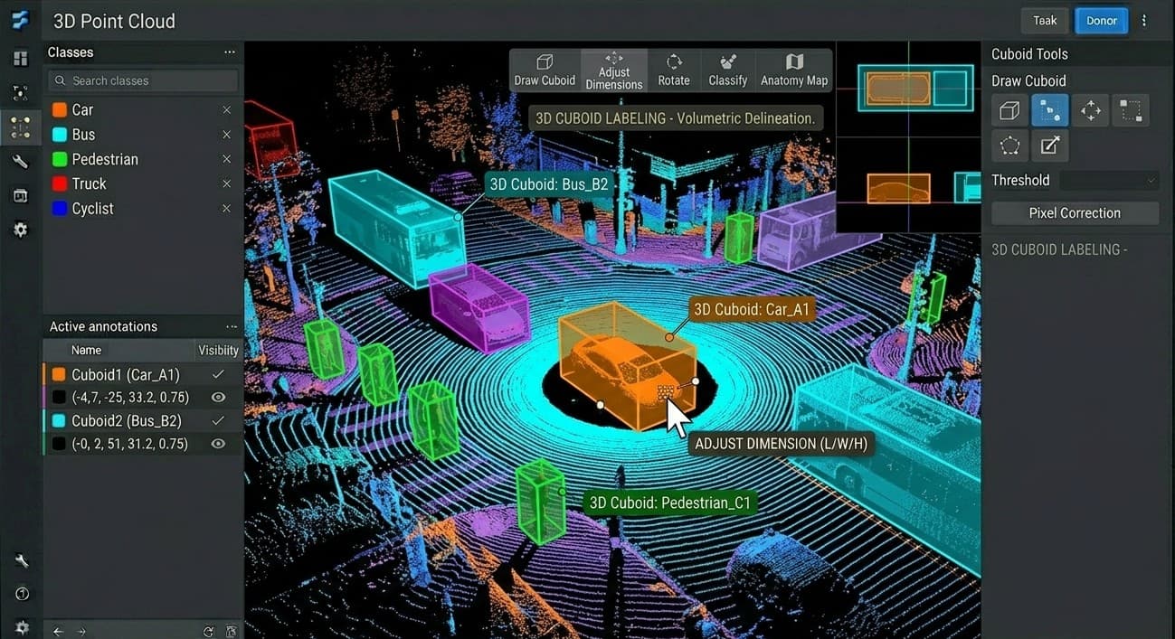
3D Cuboid Labeling
Full 3D pose and dimensions on point clouds. Volumetric boxes for vehicles, pedestrians, and obstacles—multi-class L/W/H and orientation for planning beyond flat 2D.

Point Cloud Segmentation
Semantics on every point for full-scene context. Road, sidewalk, vegetation, vehicles, buildings—with strict QC so terrain vs. obstacles stays consistent in dense scenes.

Multi-Sensor Fusion
LiDAR + camera aligned in space and time. Cuboids and segments that agree in 3D and image space—cross-view checks (BEV, camera) for stronger detection and tracking.

Lanes & Boundaries
3D polylines for lanes, curbs, and barriers. Centerlines, dividers, and road limits with elevation—topology-friendly for HD maps and lane-keeping.